
Guides · 01
Your first satellite comparison
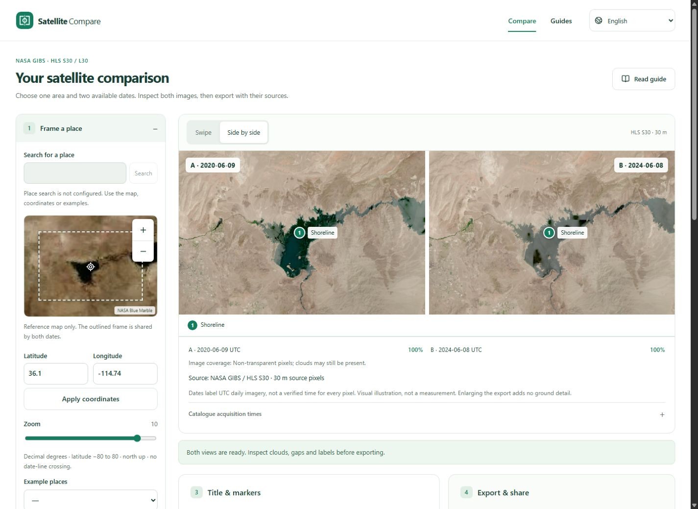
Start with a landscape large enough to see in 30 m imagery. The Lake Mead example provides a useful frame and two dates; it is a starting point for inspection, not a preset conclusion about the lake.
Updated:Frame the same place
Open Compare and choose Lake Mead. The locator controls one shared centre and zoom for both images. Pan or adjust coordinates until the area of interest fits. Keep a recognizable shoreline, road pattern or landform in the frame to help check alignment. Search within ±15 days of each target and automatically choose the nearest displayable date. Actual dates may differ from your targets.
Find, then select dates
Place changes load nearby dates automatically. Use these controls to set targets or choose image dates yourself; editing stops the current automatic request. Choose HLS Sentinel-2 and search around each target date. Pick a listed observation for A and B, then load the comparison. The targets help find candidates; the selected UTC data dates identify the images. Changing the frame or source requires a new search and load.
Inspect before annotating
Move the swipe divider and try Side by side. Look for clouds, haze and transparent gaps. Whole-granule cloud percentages are only a clue. The two views can differ in colour or brightness even where the surface has not changed.
Make a useful image
Add a short descriptive title and up to five shared markers. Export PNG for crisp labels or JPG for a smaller file. Open the file and check that both dates and NASA attribution remain legible. A share link restores settings; it does not store the images permanently.